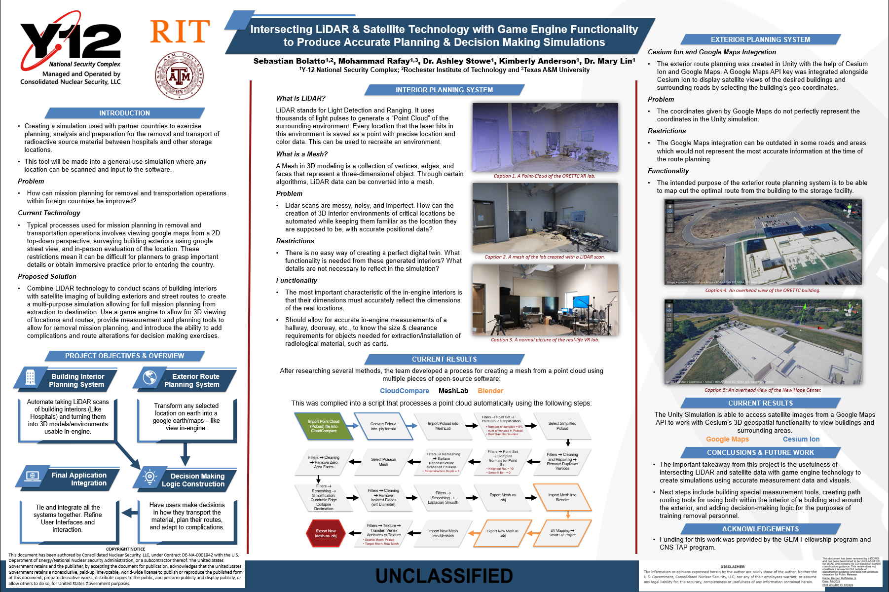
At Consolidated Nuclear Security, I worked with the Oak Ridge Enhanced Technology and Training Center (ORETTC) to create a simulation for use with partner countries to exercise planning, analysis and preparation for the removal and transport of radioactive material between hospitals and other storage locations.
I was in charge of the full creation process of this tool. This involved gathering information on what stakeholders wanted from the tool, which included being able to upload a LiDAR scan of any interior, being able to emulate moving through the whole uploaded interior, and several tools for taking measurements within the environment. They also wanted the tool to include a route-planning aspect which would allow them to view the roadways they would need to take to their destination.
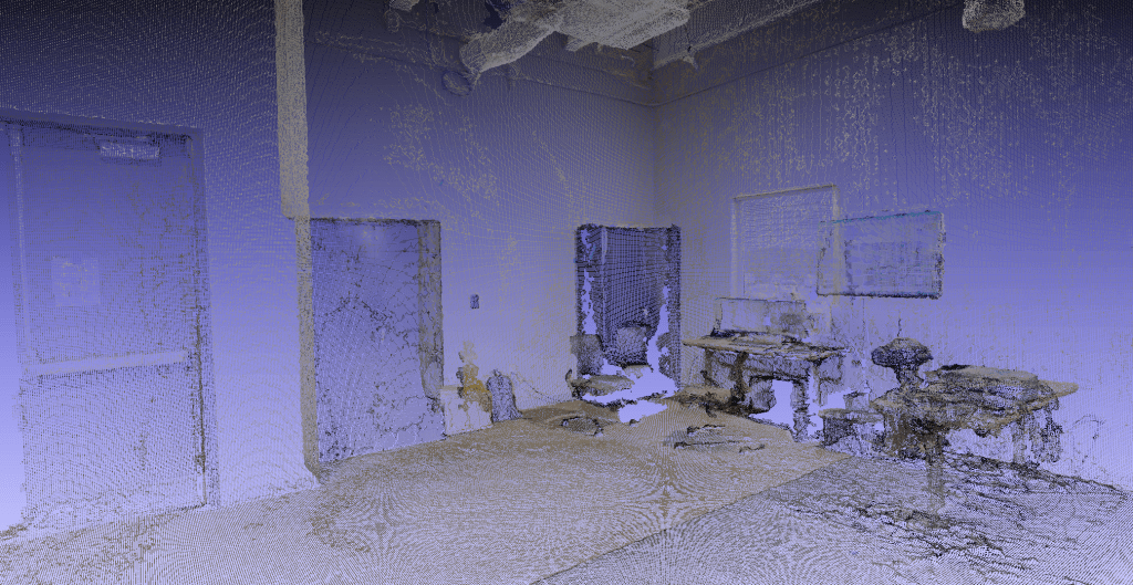
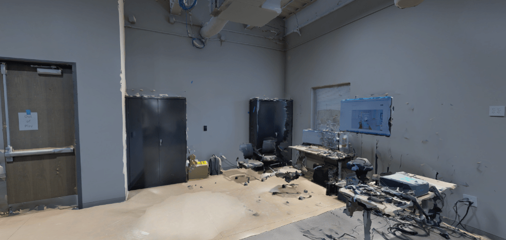
For the project, I combined LiDAR scans of building interiors with satellite imaging of street routes within the Unity game engine to create a multi-purpose simulation allowing for full mission planning from extraction to destination. In addition to this, I built a Python script that is integrated with the project, which automates the creation of a solid 3D model from a LiDAR scan’s point cloud.
Below, I provide a more in-depth introduction to the project:
Problem
How can mission planning for removal and transportation operations within foreign countries be improved?
Current Technology
Typical processes used for mission planning in removal and transportation operations involves viewing google maps from a 2D top-down perspective, surveying building exteriors using google street view, and in-person evaluation of the location. These restrictions mean it can be difficult for planners to grasp important details or obtain immersive practice prior to entering the country.
Proposed Solution
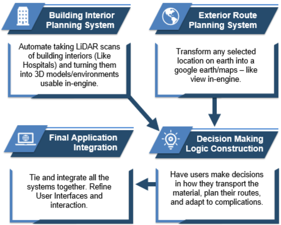
Combine LiDAR technology to conduct scans of building interiors with satellite imaging of building exteriors and street routes to create a multi-purpose simulation allowing for full mission planning from extraction to destination. Use a game engine to allow for 3D viewing of locations and routes, provide measurement and planning tools to allow for removal mission planning, and introduce the ability to add complications and route alterations for decision making exercises.
Project Objectives
Below is an unclassified poster presentation I created, describing the project’s challenges and entire process: